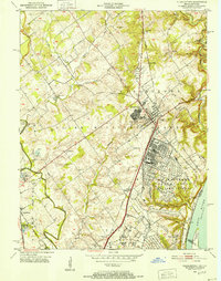
1950 Map of Charlestown
USGS Topo · Published 1952About this map
Industrial expansion and military utility define the landscape of southern Indiana during the early Cold War era. The prominent U S Military Reservation Indiana Arsenal dominates the eastern portion of the map, illustrating the significant federal footprint in the region. This installation, alongside the Clark Military Grant boundaries, highlights a region shaped by strategic land use and large-scale government presence. Meanwhile, the town of Charlestown serves as a central hub, connected to the wider world by the Baltimore and Ohio RR and Pennsylvania RR.
Find a feature on this map
62 named features on this map. Tap any name to fly to it.
Don’t see what you’re looking for? This feature index may not catch every label — zoom into the map to look around manually.
Map Details
Editions of this 1950 Charlestown Map
This is the sole edition of this map. No revisions or reprints were ever made.
Other maps of this area

1905 · Prospect
USGS Topo · 1:62,500

1912 · Prospect
USGS Topo · 1:62,500

1937 · Jeffersonville
USGS Topo · 1:24,000

1937 · Charlestown
USGS Topo · 1:24,000

1938 · Owen
USGS Topo · 1:24,000

1938 · Speed
USGS Topo · 1:24,000

1939 · New Albany
USGS Topo · 1:24,000

1946 · Jeffersonville
USGS Topo · 1:24,000

1946 · New Albany
USGS Topo · 1:24,000

1947 · Speed
USGS Topo · 1:24,000