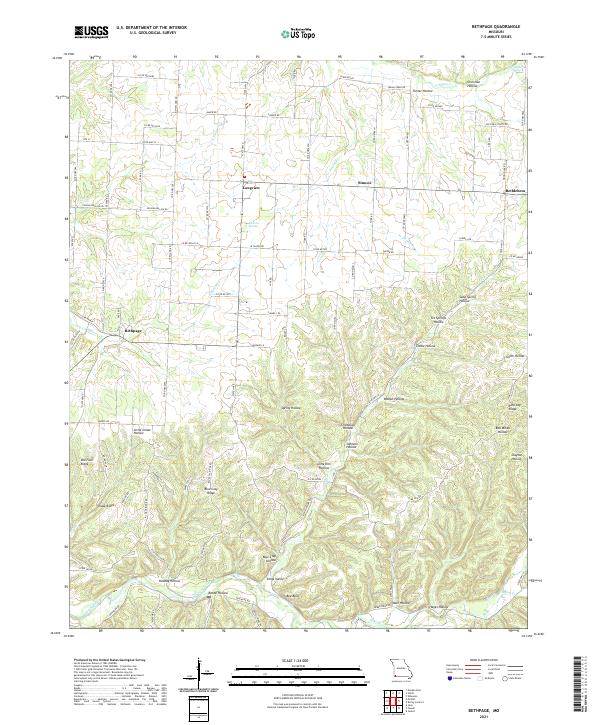
2021 Map of Bethpage
USGS Topo · Published 2021About this map
Bethpage and Longview anchor this part of McDonald County, where the landscape is defined by an intricate network of narrow valleys and high ridges. The topography is deeply etched by water, with Big Sugar Creek and Mikes Cr cutting through the southern portion of the quadrangle. Local springs such as Elkhorn Springs and He Hanken Spring suggest the hydrological character that likely influenced early settlement patterns in these hollows.
Find a feature on this map
109 named features on this map. Tap any name to fly to it.
Don’t see what you’re looking for? This feature index may not catch every label — zoom into the map to look around manually.
Map Details
Editions of this 2021 Bethpage Map
This is the sole edition of this map. No revisions or reprints were ever made.
Other maps of this area

1916 · Neosho
USGS Topo · 1:62,500

1940 · Noel
USGS Topo · 1:62,500

1941 · Rocky Comfort
USGS Topo · 1:62,500

1943 · Ritchey
USGS Topo · 1:62,500

1943 · Noel
USGS Topo · 1:62,500

1943 · Rocky Comfort
USGS Topo · 1:62,500

1954 · Tulsa
USGS Topo · 1:250,000

1958 · Tulsa
USGS Topo · 1:250,000

1963 · Tulsa
USGS Topo · 1:250,000
1972 · Wheaton
USGS Topo · 1:24,000