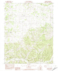
1982 Map of Bethpage
USGS Topo · Published 1982About this map
Cyclone and Bethpage anchor this southwestern Missouri landscape during the early 1980s, an area defined by its intricate network of hollows and ridges. The topography is dominated by the winding path of Big Sugar Creek and Indian Creek, with the rugged terrain of Elkhorn and Richwood creating deep drainage systems. These features influenced early settlement patterns, concentrating small communities like Longview and Simcoe along the ridges and creek valleys.
Find a feature on this map
41 named features on this map. Tap any name to fly to it.
Don’t see what you’re looking for? This feature index may not catch every label — zoom into the map to look around manually.
Map Details
Editions of this 1982 Bethpage Map
This is the sole edition of this map. No revisions or reprints were ever made.
Other maps of this area

1916 · Neosho
USGS Topo · 1:62,500

1940 · Noel
USGS Topo · 1:62,500

1941 · Rocky Comfort
USGS Topo · 1:62,500

1943 · Ritchey
USGS Topo · 1:62,500

1943 · Noel
USGS Topo · 1:62,500

1943 · Rocky Comfort
USGS Topo · 1:62,500

1954 · Tulsa
USGS Topo · 1:250,000

1958 · Tulsa
USGS Topo · 1:250,000

1963 · Tulsa
USGS Topo · 1:250,000
1972 · Wheaton
USGS Topo · 1:24,000