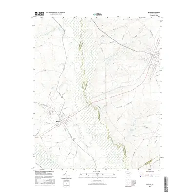
2017 Map of Bethune
USGS Topo · Published 2017About this map
The Lynches River forms a wide, meandering boundary between Kershaw and Chesterfield counties, defining the landscape of this 2017 survey. The town of Bethune serves as a primary hub in the southwest, where the grid of streets includes King St W and Main St N. To the northeast, the smaller settlement of McBee is situated along the county line, surrounded by a network of rural routes such as Wire 4 Rd and Sowell Town Rd.
Find a feature on this map
88 named features on this map. Tap any name to fly to it.
Don’t see what you’re looking for? This feature index may not catch every label — zoom into the map to look around manually.
Map Details
Editions of this 2017 Bethune Map
This is the sole edition of this map. No revisions or reprints were ever made.
Other maps of this area

1941 · Spartanburg
USGS Topo · 1:250,000

1953 · Spartanburg
USGS Topo · 1:250,000

1960 · Spartanburg
USGS Topo · 1:250,000

1963 · Spartanburg
USGS Topo · 1:250,000

1964 · Spartanburg
USGS Topo · 1:250,000

1967 · Angelus
USGS Topo · 1:24,000

1967 · Mount Pisgah
USGS Topo · 1:24,000

1968 · Middendorf
USGS Topo · 1:24,000
1968 · Lake Robinson
USGS Topo · 1:24,000

1968 · Kellytown
USGS Topo · 1:24,000