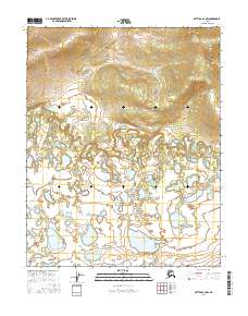
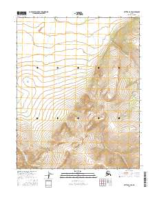
2016 Map of Bettles A-4 NW
USGS Topo · Published 2016About this map
The Kanuti River winds through this section of the Yukon-Koyukuk region, creating a complex network of oxbows and wetlands characteristic of the Alaskan interior. This 2016 survey captures a landscape defined by water and low-lying topography, where the river's shifting course has left behind numerous small unnamed ponds and larger bodies like Old Dummy Lake. In the eastern portion of the map, the terrain begins to transition from the saturated river valley toward the shores of Kanuti Lake. The absence of roads or permanent settlements underscores the wilderness character of the area, which is primarily organized by the Public Land Survey System grids of t16n r21w and t15n r20w. This documentation is essential for understanding the natural drainage patterns and the untouched geography of the Kanuti Flats before environmental shifts or future land-use changes alter the shoreline boundaries.
Find a feature on this map
7 named features on this map. Tap any name to fly to it.
Don’t see what you’re looking for? This feature index may not catch every label — zoom into the map to look around manually.
Map Details
Editions of this 2016 Bettles A-4 NW Map
This is the sole edition of this map. No revisions or reprints were ever made.
Other maps of this area

1951 · Bettles
USGS Topo · 1:250,000

1956 · Bettles
USGS Topo · 1:250,000
1970 · Bettles B-4
USGS Topo · 1:63,360
1970 · Bettles A-4
USGS Topo · 1:63,360
1970 · Bettles B-5
USGS Topo · 1:63,360
1970 · Bettles A-5
USGS Topo · 1:63,360
2016 · Bettles B-4 SE
USGS Topo · 1:25,000
2016 · Bettles B-4 SW
USGS Topo · 1:25,000
2016 · Bettles B-5 SE
USGS Topo · 1:25,000
2016 · Bettles A-4 SE
USGS Topo · 1:25,000