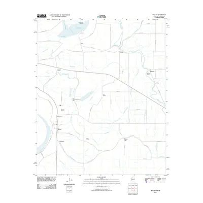
2011 Map of Beulah
USGS Topo · Published 2011About this map
Beulah and its surrounding Delta landscape are defined by a complex network of bayous and agricultural land use in this 2011 survey. The town sits just east of the Mississippi River Levee, where the local economy and settlement patterns are dictated by the flow of water through systems like Laban Bayou and Bogue Phalia. This map is particularly valuable for genealogists, as it preserves the locations of several community burial grounds, including Beulah Cemetery, Waldon Cemetery, and Scotland Cemetery, often located near crossroads or vanished hamlets like Gill and Christmas.
Find a feature on this map
61 named features on this map. Tap any name to fly to it.
Don’t see what you’re looking for? This feature index may not catch every label — zoom into the map to look around manually.
Map Details
Editions of this 2011 Beulah Map
This is the sole edition of this map. No revisions or reprints were ever made.
Other maps of this area

1933 · Lamont
USGS Topo · 1:62,500

1939 · Pace
USGS Topo · 1:62,500

1939 · Big Island
USGS Topo · 1:62,500

1939 · Lamont
USGS Topo · 1:62,500

1939 · Choctaw
USGS Topo · 1:62,500

1953 · Greenwood
USGS Topo · 1:250,000

1956 · Greenwood
USGS Topo · 1:250,000
1967 · Skene
USGS Topo · 1:24,000

1967 · Lobdell
USGS Topo · 1:24,000
1969 · Choctaw
USGS Topo · 1:62,500