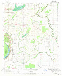
1969 Map of Beulah
USGS Topo · Published 1971About this map
Lake Beulah and the adjacent Mississippi River dominate this 1969 Delta landscape, marking the complex boundary between Bolivar County, Mississippi, and Desha County, Arkansas. The map reveals a land shaped by water and agriculture, where numerous Indian Mounds sit near the winding banks of Bogue Phalia and Laban Bayou. The town of Beulah serves as a local hub along the Illinois Central railroad line, surrounded by smaller settlements like Niles, Malvina, and Mound City.
Find a feature on this map
46 named features on this map. Tap any name to fly to it.
Don’t see what you’re looking for? This feature index may not catch every label — zoom into the map to look around manually.
Map Details
Editions of this 1969 Beulah Map
This is the sole edition of this map. No revisions or reprints were ever made.
Other maps of this area

1933 · Lamont
USGS Topo · 1:62,500

1939 · Pace
USGS Topo · 1:62,500

1939 · Big Island
USGS Topo · 1:62,500

1939 · Lamont
USGS Topo · 1:62,500

1939 · Choctaw
USGS Topo · 1:62,500

1953 · Greenwood
USGS Topo · 1:250,000

1956 · Greenwood
USGS Topo · 1:250,000
1967 · Skene
USGS Topo · 1:24,000

1967 · Lobdell
USGS Topo · 1:24,000
1969 · Choctaw
USGS Topo · 1:62,500