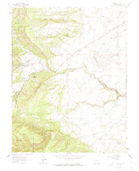
1963 Map of Beulah
USGS Topo · Published 1974About this map
The mountain community of Beulah sits at the foot of Hogback Mountain, where the St Charles River and its various forks descend toward the plains. This 1963 field-checked survey documents the local infrastructure of the era, including the Ranger Station, a Filtration Plant, and the Beulah Cem. The landscape is defined by its transition from the steep elevations of the San Isabel National Forest to the lower, broken terrain of Turtle Buttes and Bantam Hill to the east.
Find a feature on this map
34 named features on this map. Tap any name to fly to it.
Don’t see what you’re looking for? This feature index may not catch every label — zoom into the map to look around manually.
Map Details
Editions of this 1963 Beulah Map
3 editions found
Other maps of this area

1889 · Canon City
USGS Topo · 1:125,000

1889 · Huerfano Park
USGS Topo · 1:125,000

1891 · Walsenburg
USGS Topo · 1:125,000

1891 · Pueblo
USGS Topo · 1:125,000

1892 · Huerfano Park
USGS Topo · 1:125,000

1892 · Canon City
USGS Topo · 1:125,000

1894 · Walsenburg
USGS Topo · 1:125,000

1894 · Pueblo
USGS Topo · 1:125,000

1896 · Pueblo
USGS Topo · 1:125,000

1897 · Pueblo
USGS Topo · 1:125,000