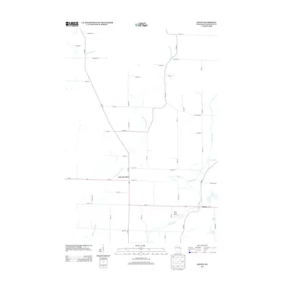
2013 Map of Bevent
USGS Topo · Published 2013About this map
Bevent and Little Eau Claire serve as the primary human hubs in this eastern Marathon County landscape, where the Plover River and Little Eau Claire River snake through a patchwork of agricultural plots and woodland. The map reveals a rural economy centered on a dense network of county roads and local lanes, many named for local families such as Kellner Rd, Dallman Rd, and Kristof Rd. A notable modern landmark is the Plover River Airfield, situated south of Wi-153 near the river's bend. The terrain is further defined by glacial hydrology, with Bear Lake, Turtle Lake, and Fox Lake dotting the southeastern corner, while smaller tributaries like Bull Junior Cr and Pike Lake Cr drain the surrounding basins. This survey offers a clear view of the transition between the managed timber and farm tracts of central Wisconsin in the early 21st century.
Find a feature on this map
48 named features on this map. Tap any name to fly to it.
Don’t see what you’re looking for? This feature index may not catch every label — zoom into the map to look around manually.
Map Details
Editions of this 2013 Bevent Map
This is the sole edition of this map. No revisions or reprints were ever made.
Other maps of this area

1899 · Wausau
USGS Topo · 1:125,000

1902 · Wausau
USGS Topo · 1:125,000

1953 · Wausau
USGS Topo · 1:48,000

1953 · Hatley
USGS Topo · 1:48,000

1955 · Rosholt
USGS Topo · 1:48,000

1955 · Green Bay
USGS Topo · 1:250,000

1956 · Stevens Point
USGS Topo · 1:48,000
1963 · Wausau East
USGS Topo · 1:24,000

1963 · Wausau
USGS Topo · 1:62,500

1964 · Hatley
USGS Topo · 1:62,500