
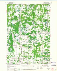
1955 Map of Rosholt
USGS Topo · Published 1957About this map
Glacial lakes and small farming communities define this central Wisconsin landscape during the mid-1950s. The village of Rosholt serves as a local hub near Mill Pond, surrounded by a dense network of rural schools that reflect the era's changing educational geography, including the Tomorrow River Sch and Harrison Sch. Religious life is anchored by prominent landmarks such as St Adalbert Sch and St Marys Ch, while the Minneapolis St Paul and Sault Ste Marie railroad skirts the southern edge through Custer and Stockton. The terrain is characterized by numerous water bodies like Wadley Lake and Hintz Lake, interspersed with woodlots and wetlands. This survey provides a clear view of the transition from early 20th-century settlement patterns to a more modern infrastructure, noting several decommissioned sites such as the Malloy Sch and Rinehart Sch.
Find a feature on this map
71 named features on this map. Tap any name to fly to it.
Don’t see what you’re looking for? This feature index may not catch every label — zoom into the map to look around manually.
Map Details
Editions of this 1955 Rosholt Map
2 editions found
Other maps of this area

1899 · Wausau
USGS Topo · 1:125,000

1902 · Wausau
USGS Topo · 1:125,000

1953 · Wausau
USGS Topo · 1:48,000

1953 · Hatley
USGS Topo · 1:48,000

1954 · Wittenberg
USGS Topo · 1:48,000

1955 · Tigerton
USGS Topo · 1:48,000

1955 · Green Bay
USGS Topo · 1:250,000

1956 · Stevens Point
USGS Topo · 1:48,000

1957 · Amherst
USGS Topo · 1:48,000

1957 · Waupaca
USGS Topo · 1:48,000