
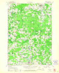
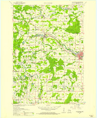
1955 Map of Tigerton
USGS Topo · Published 1957About this map
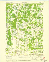
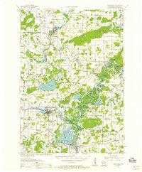
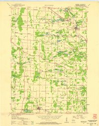
Tigerton and its surrounding rural townships in Shawano and Waupaca Counties are defined by a complex network of glacial lakes and river branches as they appeared in the mid-1950s. The Chicago And North Western railroad corridor serves the northern settlements, passing through Split Rock near the Tigerton Dells. The landscape is dotted with evidence of early 20th-century social structures, including numerous small country schools like the Blue Ribbon Sch and Thoe Sch, some of which were already marked as the Northland Sch (Abandoned) by the time of this field examination. The southern portion of the sheet is anchored by Iola, where the Little Wolf River feeds into the Mill Pond. Significant topographic features such as Stony Ridge and the Tigerton Lookout Tower overlook a terrain transitioning between agricultural clearings and dense woodland, while spiritual centers like Hitterdahl Ch remain central to the rural community identity.
Find a feature on this map
72 named features on this map. Tap any name to fly to it.
Don’t see what you’re looking for? This feature index may not catch every label — zoom into the map to look around manually.
Map Details
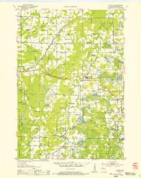
Editions of this 1955 Tigerton Map
2 editions found
Other maps of this area

1899 · Wausau
USGS Topo · 1:125,000

1902 · Wausau
USGS Topo · 1:125,000
1953 · Hatley
USGS Topo · 1:48,000
1954 · Wittenberg
USGS Topo · 1:48,000
1954 · Gresham
USGS Topo · 1:48,000
1955 · Clintonville
USGS Topo · 1:48,000
1955 · Rosholt
USGS Topo · 1:48,000

1955 · Green Bay
USGS Topo · 1:250,000
1956 · Weyauwega
USGS Topo · 1:48,000
1957 · Amherst
USGS Topo · 1:48,000