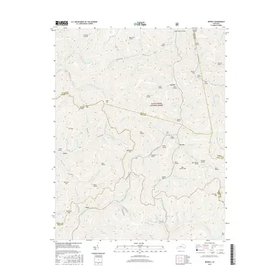
2016 Map of Beverly
USGS Topo · Published 2016About this map
The mountain settlements of Beverly and Gardner are situated within the eastern reaches of the Daniel Boone National Forest, where the headwaters of Goose Cr and Red Bird Cr carve through a landscape of steep ridges and numerous hollows. This area is defined by the convergence of several county boundaries, including Clay, Bell, Leslie, and Knox. The terrain is marked by distinctive family-named landmarks like Asher Cem and the Bob Slusher Gap, alongside evidence of regional industry found on Strip Mine Rd. Geologic features such as the Kentucky Ridge and the Left Fork Upper Blue Hole suggest the complex hydrology of this part of the Cumberland Plateau. The distribution of small gaps like Sugar Gap and Bear Wallow Gap provides insight into the historical transportation corridors used to traverse these difficult Appalachian summits.
Find a feature on this map
104 named features on this map. Tap any name to fly to it.
Don’t see what you’re looking for? This feature index may not catch every label — zoom into the map to look around manually.
Map Details
Editions of this 2016 Beverly Map
This is the sole edition of this map. No revisions or reprints were ever made.
Other maps of this area

1886 · Cumberland Gap
USGS Topo · 1:125,000

1887 · Jonesville
USGS Topo · 1:125,000

1888 · Cumberland Gap
USGS Topo · 1:125,000

1891 · Manchester
USGS Topo · 1:125,000

1891 · Cumberland Gap
USGS Topo · 1:125,000

1891 · Hazard
USGS Topo · 1:125,000

1891 · Jonesville
USGS Topo · 1:125,000

1903 · Harlan
USGS Topo · 1:48,000

1903 · Pineville
USGS Topo · 1:48,000

1916 · Harlan
USGS Topo · 1:48,000