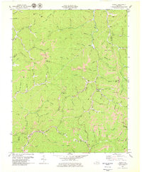
1979 Map of Beverly
USGS Topo · Published 1979About this map
Beverly stands at the heart of this 1979 survey, where the boundaries of Bell, Clay, and Leslie counties converge. The local landscape is deeply defined by the industrial footprint of extractive resource management, shown through extensive Strip Mines and numerous unnamed mines dotting the ridges above Alex Creek and Straight Creek. The Red Bird Settlement Sch and Cow Fork Ch provide clear landmarks for genealogical research, while several cemeteries are tucked into the hollows of the Cumberland Plateau. A lookout tower on a northern ridge and a tipple near the Louisville and Nashville tracks along the southern edge of the sheet illustrate the intersection of forestry surveillance and the coal-hauling rail economy. Winding watercourses like Indian Grave Branch and Pigeon Roost Branch reveal the intricate topography of the region as it existed before contemporary reclamation efforts.
Find a feature on this map
114 named features on this map. Tap any name to fly to it.
Don’t see what you’re looking for? This feature index may not catch every label — zoom into the map to look around manually.
Map Details
Editions of this 1979 Beverly Map
This is the sole edition of this map. No revisions or reprints were ever made.
Other maps of this area

1886 · Cumberland Gap
USGS Topo · 1:125,000

1887 · Jonesville
USGS Topo · 1:125,000

1888 · Cumberland Gap
USGS Topo · 1:125,000

1891 · Manchester
USGS Topo · 1:125,000

1891 · Cumberland Gap
USGS Topo · 1:125,000

1891 · Hazard
USGS Topo · 1:125,000

1891 · Jonesville
USGS Topo · 1:125,000

1903 · Harlan
USGS Topo · 1:48,000

1903 · Pineville
USGS Topo · 1:48,000

1916 · Harlan
USGS Topo · 1:48,000