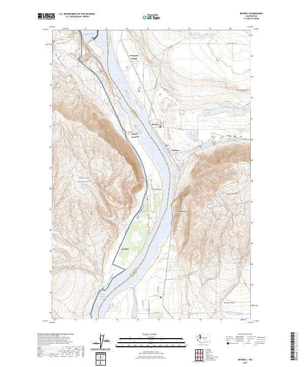
2023 Map of Beverly
USGS Topo · Published 2023About this map
The Columbia River carves a dramatic path through this central Washington landscape, flanked by the massive Saddle Mountains to the east and the expansive Joint Base Lewis-McChord to the west. This river corridor is a site of significant hydrological engineering, where the river transitions from Wanapum Lake through the narrow Sentinel Gap and into Priest Rapids Lake. The small settlements of Beverly, Schwana, and Wanapum Village are positioned along these waters, reflecting a landscape defined by both power generation and conservation. To the northeast, the Columbia National Wildlife Refuge preserves the riparian environment near Lower Crab Creek and Nunnally Lake. The presence of Beverly Junction and the Cascades State Park Trl indicate the enduring importance of transport and recreation in this arid, high-contrast terrain.
Find a feature on this map
34 named features on this map. Tap any name to fly to it.
Don’t see what you’re looking for? This feature index may not catch every label — zoom into the map to look around manually.
Map Details
Editions of this 2023 Beverly Map
This is the sole edition of this map. No revisions or reprints were ever made.
Other maps of this area

1912 · Beverly
USGS Topo · 1:62,500

1917 · Priest Rapids
USGS Topo · 1:62,500

1936 · Hog Ranch Buttes
USGS Topo · 1:48,000

1939 · Boylston
USGS Topo · 1:48,000

1941 · Black Rock Spring
USGS Topo · 1:62,500

1943 · Boylston
USGS Topo · 1:62,500

1948 · Priest Rapids
USGS Topo · 1:24,000

1950 · Yakima
USGS Topo · 1:250,000

1951 · Priest Rapids
USGS Topo · 1:62,500

1953 · Ginkgo
USGS Topo · 1:24,000