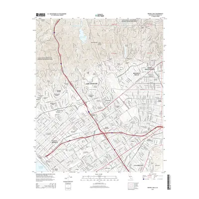
2015 Map of Beverly Hills
USGS Topo · Published 2015About this map
University of California-Los Angeles stands as a central academic anchor in this mid-2010s urban landscape, situated just north of Westwood Village. The dense residential and commercial grids of West Los Angeles and Beverly Hills are clearly defined, contrasting with the undeveloped slopes of the Santa Monica Mountains National Recreation Area to the north. Transportation corridors like Santa Monica Blvd and Wilshire Blvd link the coastal reaches of Santa Monica and Venice to the inland centers of West Hollywood and Culver City. Infrastructure for the growing metropolis is visible in the Stone Canyon Reservoir and the Santa Monica Municipal Airport. Smaller neighborhoods and junctions, including Sawtelle, Palms, and Home Junction, provide a detailed view of the city's complex organizational structure.
Find a feature on this map
80 named features on this map. Tap any name to fly to it.
Don’t see what you’re looking for? This feature index may not catch every label — zoom into the map to look around manually.
Map Details
Editions of this 2015 Beverly Hills Map
This is the sole edition of this map. No revisions or reprints were ever made.
Other maps of this area

1894 · Los Angeles
USGS Topo · 1:62,500

1896 · Redondo
USGS Topo · 1:62,500

1896 · Santa Monica
USGS Topo · 1:62,500

1898 · Santa Monica
USGS Topo · 1:62,500

1900 · Los Angeles
USGS Topo · 1:62,500

1901 · Southern California Sheet No. 1
USGS Topo · 1:250,000

1902 · Santa Monica
USGS Topo · 1:62,500

1903 · Calabasas
USGS Topo · 1:62,500

1903 · Camulos
USGS Topo · 1:125,000

1904 · Southern California Sheet No. 1
USGS Topo · 1:250,000