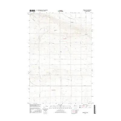
2017 Map of Beverly NE
USGS Topo · Published 2017About this map
The Frenchman Hills define this corner of Grant County, where the high ridge terrain transitions into the expansive agricultural geography of the Royal Slope. This 2017 survey details the complex network of section-line roads and interior passages through the hills, including the strategic crossing at Low Gap and the nearby Low Gap Pass. The map illustrates a landscape shaped by both the natural rise of the hills and the systematic human organization of the land, visible through the grid of roads such as Frenchman Hills Rd W and Beverly Burke Rd. Researchers can observe the interplay between the topography and the county’s infrastructure, tracing how transportation routes like Adams Rd S follow the contours of the valley floor below the northern heights.
Find a feature on this map
27 named features on this map. Tap any name to fly to it.
Don’t see what you’re looking for? This feature index may not catch every label — zoom into the map to look around manually.
Map Details
Editions of this 2017 Beverly NE Map
This is the sole edition of this map. No revisions or reprints were ever made.
Other maps of this area

1909 · Quincy
USGS Topo · 1:62,500

1910 · Quincy
USGS Topo · 1:62,500

1910 · Winchester
USGS Topo · 1:62,500

1911 · Red Rock
USGS Topo · 1:62,500

1912 · Beverly
USGS Topo · 1:62,500

1950 · Smyrna
USGS Topo · 1:62,500

1951 · Smyrna
USGS Topo · 1:62,500

1953 · Walla Walla
USGS Topo · 1:250,000

1953 · Ritzville
USGS Topo · 1:250,000

1954 · Beverly NE
USGS Topo · 1:24,000