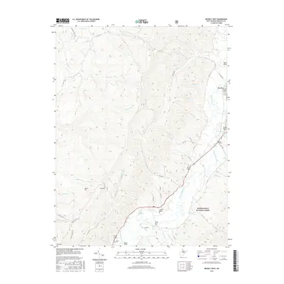
2016 Map of Beverly West
USGS Topo · Published 2016About this map
The Tygart Valley River carves a narrow, fertile corridor through the high ridges of Randolph County, providing the primary axis for settlement in this part of the Appalachian plateau. The historic town of Beverly sits at the northern end of this reach, while further south, small communities like Valley Bend and Valley Truss occupy the valley floor near the Valley Bend Wetland. The landscape is defined by the steep elevation changes rising toward the west, where Rich Mtn and Nettle Mtn form formidable barriers cut by deep drainages like Cassity Fork and Roaring Cr. Genealogists will find interest in Crouch Cem near the riverbanks, while the presence of Prison Mine Rd and the vast Monongahela National Forest boundary highlight the area's legacy of resource management and timber land. Landmark features such as the Burnt Bridge and Scott Lake mark significant points along the valley’s transportation and recreation network.
Find a feature on this map
47 named features on this map. Tap any name to fly to it.
Don’t see what you’re looking for? This feature index may not catch every label — zoom into the map to look around manually.
Map Details
Editions of this 2016 Beverly West Map
This is the sole edition of this map. No revisions or reprints were ever made.
Other maps of this area

1889 · Beverly
USGS Topo · 1:125,000

1892 · Beverly
USGS Topo · 1:125,000

1893 · Buckhannon
USGS Topo · 1:125,000

1896 · Buckhannon
USGS Topo · 1:125,000

1897 · Buckhannon
USGS Topo · 1:125,000

1909 · Elkins
USGS Topo · 1:62,500

1912 · Sago
USGS Topo · 1:48,000

1913 · Pickens
USGS Topo · 1:48,000

1914 · Sago
USGS Topo · 1:62,500

1915 · Pickens
USGS Topo · 1:62,500