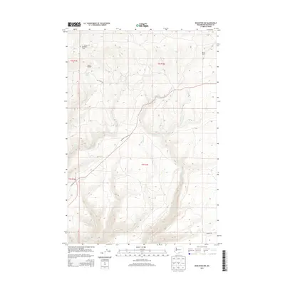
2013 Map of Bickleton NW
USGS Topo · Published 2013About this map
Bickleton Ridge dominates the northern landscape of this Klickitat County region, marking the high ground above a complex network of seasonal drainages and canyons. In the early 21st century, this area remains characterized by its ranching and agricultural heritage, centered around vital water sources such as Milk Ranch Spring and Box Springs. The map details the rugged transitions from heights like Dairy Canyon down toward the winding paths of Squaw Cr and Harrison Cr. Transportation in this portion of Washington is defined by long-established routes, including the Goldendale Bickleton Rd, which navigates the undulating terrain. Small, family-named landmarks like Wood Gulch and Gadeberg Rd provide essential points of reference for local historians and genealogists tracing the legacy of land use in this part of the Columbia Plateau.
Find a feature on this map
18 named features on this map. Tap any name to fly to it.
Don’t see what you’re looking for? This feature index may not catch every label — zoom into the map to look around manually.
Map Details
Editions of this 2013 Bickleton NW Map
This is the sole edition of this map. No revisions or reprints were ever made.
Other maps of this area

1910 · Zillah
USGS Topo · 1:125,000

1916 · Arlington
USGS Topo · 1:125,000

1937 · White Swan
USGS Topo · 1:125,000

1950 · Yakima
USGS Topo · 1:250,000

1953 · The Dalles
USGS Topo · 1:250,000

1956 · The Dalles
USGS Topo · 1:250,000

1957 · The Dalles
USGS Topo · 1:250,000

1957 · Satus Pass
USGS Topo · 1:62,500

1958 · Yakima
USGS Topo · 1:250,000

1961 · Yakima
USGS Topo · 1:250,000