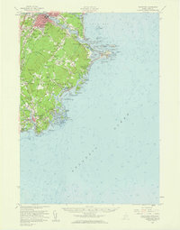
1956 Map of Biddeford
USGS Topo · Published 1960About this map
The coastal economy of southern Maine centers on the industrial hubs of Biddeford and Saco, where the Saco River meets the Atlantic at Saco Bay. This mid-century portrait captures a landscape defined by traditional fishing harbors and rising leisure communities, showing the transition from the river's textile-milling history at Factory Island to the seasonal resorts of Ocean Park and Kennebunk Beach. The intricate shoreline is anchored by maritime safety markers like the Wood I Lighthouse and Goat I Lighthouse, while inland, the settlement pattern reveals small family-named crossroads like Adams Corner, Guinea Corner, and Tea Kettle Corner. Educational and religious institutions including St Francis College and Stella Maris Convent stand near the river's mouth. Transportation is dominated by the Boston and Maine Railroad and the coastal Guinea Road, while local cultural history is represented by the Trolley Museum near Arundel.
Find a feature on this map
156 named features on this map. Tap any name to fly to it.
Don’t see what you’re looking for? This feature index may not catch every label — zoom into the map to look around manually.
Map Details
Editions of this 1956 Biddeford Map
2 editions found
Other maps of this area

1891 · Portland
USGS Topo · 1:62,500

1891 · Biddeford
USGS Topo · 1:62,500

1891 · Kennebunk
USGS Topo · 1:62,500

1891 · Buxton
USGS Topo · 1:62,500

1892 · Buxton
USGS Topo · 1:62,500

1893 · Kennebunk
USGS Topo · 1:62,500

1893 · York
USGS Topo · 1:62,500

1893 · Biddeford
USGS Topo · 1:62,500

1893 · Portland
USGS Topo · 1:62,500

1893 · Casco Bay
USGS Topo · 1:62,500