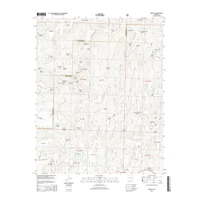
2014 Map of Bidville
USGS Topo · Published 2014About this map
Bidville occupies a high plateau in the northern reaches of the Ozark National Forest, where the headwaters of the Mulberry River and Frog Bayou carve deep into the Crawford and Franklin County line. This 2014 survey documents a landscape where traditional Ozark settlement patterns remain visible through several family and community burial grounds, including the Bidville Cem, Phillips Cem, and Shores Cem. The topography is defined by high points like White Rock Mtn and Potato Knob Mtn, while the southern portion of the quadrangle shows the footprint of the Paradise Gas Field near Nix Hollow. The map traces the winding paths of State Hwy 215 and Shores Lake Rd, illustrating how modern infrastructure follows the natural corridors created by drainages like White Rock Cr and Salt Fork Cr.
Find a feature on this map
72 named features on this map. Tap any name to fly to it.
Don’t see what you’re looking for? This feature index may not catch every label — zoom into the map to look around manually.
Map Details
Editions of this 2014 Bidville Map
This is the sole edition of this map. No revisions or reprints were ever made.
Other maps of this area

1879 · Cravens
USGS Topo · 1:62,500

1887 · Watalula
USGS Topo · 1:62,500

1898 · Winslow #4
USGS Topo · 1:62,500

1898 · Winslow
USGS Topo · 1:125,000

1901 · Winslow
USGS Topo · 1:125,000

1939 · Watalula
USGS Topo · 1:62,500

1943 · St. Paul
USGS Topo · 1:62,500

1946 · St. Paul
USGS Topo · 1:62,500

1946 · Fort Smith
USGS Topo · 1:250,000

1956 · Russellville
USGS Topo · 1:250,000