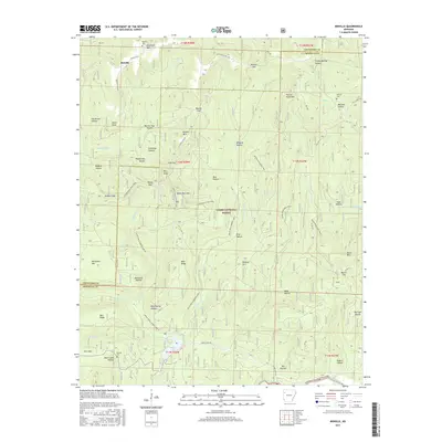
2017 Map of Bidville
USGS Topo · Published 2017About this map
Bidville sits atop the high ridges of the Ozark National Forest, marking a long-standing settlement area in the Boston Mountains. This 2017 survey details the complex network of hollows and gaps that define the drainage basins for Hurricane Creek and the Mulberry River. The landscape is etched with local history, from the Bidville Cemetery near the town site to the remote Phillips Cemetery tucked into the northern ridges.
Find a feature on this map
76 named features on this map. Tap any name to fly to it.
Don’t see what you’re looking for? This feature index may not catch every label — zoom into the map to look around manually.
Map Details
Editions of this 2017 Bidville Map
This is the sole edition of this map. No revisions or reprints were ever made.
Other maps of this area

1879 · Cravens
USGS Topo · 1:62,500

1887 · Watalula
USGS Topo · 1:62,500

1898 · Winslow #4
USGS Topo · 1:62,500

1898 · Winslow
USGS Topo · 1:125,000

1901 · Winslow
USGS Topo · 1:125,000

1939 · Watalula
USGS Topo · 1:62,500

1943 · St. Paul
USGS Topo · 1:62,500

1946 · St. Paul
USGS Topo · 1:62,500

1946 · Fort Smith
USGS Topo · 1:250,000

1956 · Russellville
USGS Topo · 1:250,000