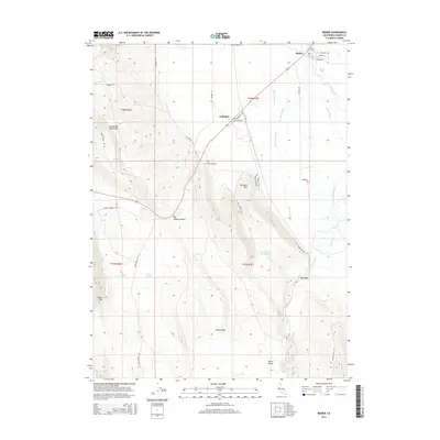
2015 Map of Bieber
USGS Topo · Published 2015About this map
Bieber and Nubieber anchor this portion of Lassen County, positioned where the Pit River winds through the expansive Big Valley. The geography is defined by a transition from the level bottomlands of the valley floor to the prominent heights of the Big Valley Mountains. Water management is a visible priority across the landscape, evidenced by the intricate network of waterways including Bull Run Slough, Egg Lake Slough, and Gobel Slough, alongside established catchments like Thompson Reservoir and Hardin Reservoir. Local history and genealogy researchers will find Hillside Cemetery situated north of the mountains, while landmarks such as Big Valley Summit and Ricketts Hill provide clear topographic reference points. The road network, featuring routes like Pittville Beach Rd and Muck Valley Rd, connects the small settlements to outlying features like Mullens Spring and Johns Valley.
Find a feature on this map
39 named features on this map. Tap any name to fly to it.
Don’t see what you’re looking for? This feature index may not catch every label — zoom into the map to look around manually.
Map Details
Editions of this 2015 Bieber Map
This is the sole edition of this map. No revisions or reprints were ever made.
Other maps of this area

1886 · Lassen Peak
USGS Topo · 1:250,000

1886 · Modoc Lava Bed
USGS Topo · 1:250,000

1892 · Modoc Lava-Bed
USGS Topo · 1:250,000

1892 · Lassen Peak
USGS Topo · 1:250,000

1894 · Lassen Peak
USGS Topo · 1:250,000

1939 · Halls Flat
USGS Topo · 1:125,000

1954 · Alturas
USGS Topo · 1:250,000

1955 · Westwood
USGS Topo · 1:250,000

1957 · Little Valley
USGS Topo · 1:62,500

1957 · Jellico
USGS Topo · 1:62,500