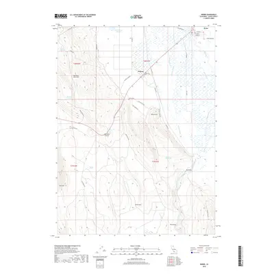
2018 Map of Bieber
USGS Topo · Published 2018About this map
Bieber and its rail-linked neighbor Nubieber sit at the northern end of this northeastern California survey, where the Pit River winds through the floor of Big Valley. The landscape is defined by the sharp transition between these low-lying wetlands and the high elevations of the Big Valley Mountains. Water management is central to the area's geography, evidenced by features such as Nine Springs Reservoir, Bagwell Reservoir, and the complex network of sloughs like Gobel Slough and Egg Lake Slough that drain the valley. Historically, the area's movement is marked by the Old Toll RD and the paths leading to Big Valley Summit. Local family and community roots can be traced through the Hillside Cem and numerous named valleys like Johns Valley and Muck Valley, showing how the geography was divided and utilized in this remote corner of Lassen County.
Find a feature on this map
43 named features on this map. Tap any name to fly to it.
Don’t see what you’re looking for? This feature index may not catch every label — zoom into the map to look around manually.
Map Details
Editions of this 2018 Bieber Map
This is the sole edition of this map. No revisions or reprints were ever made.
Other maps of this area

1886 · Lassen Peak
USGS Topo · 1:250,000

1886 · Modoc Lava Bed
USGS Topo · 1:250,000

1892 · Modoc Lava-Bed
USGS Topo · 1:250,000

1892 · Lassen Peak
USGS Topo · 1:250,000

1894 · Lassen Peak
USGS Topo · 1:250,000

1939 · Halls Flat
USGS Topo · 1:125,000

1954 · Alturas
USGS Topo · 1:250,000

1955 · Westwood
USGS Topo · 1:250,000

1957 · Little Valley
USGS Topo · 1:62,500

1957 · Jellico
USGS Topo · 1:62,500