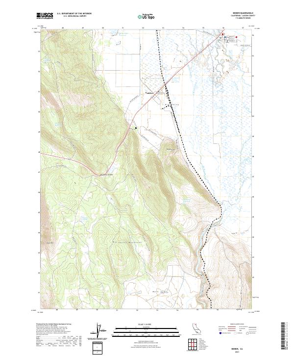
2021 Map of Bieber
USGS Topo · Published 2021About this map
Nubieber sits at the northern edge of this Lassen County landscape, marking a vital junction where the highway crosses the vast agricultural and wetland expanse of Big Valley. The terrain is defined by the complex hydrology of the Pit River and its associated waterways, including Bull Run Slough and Egg Lake Slough. These slow-moving waters wind through a flat basin before the elevation rises sharply into the Big Valley Mountains and Big Valley Summit to the south.
Find a feature on this map
42 named features on this map. Tap any name to fly to it.
Don’t see what you’re looking for? This feature index may not catch every label — zoom into the map to look around manually.
Map Details
Editions of this 2021 Bieber Map
This is the sole edition of this map. No revisions or reprints were ever made.
Other maps of this area

1886 · Lassen Peak
USGS Topo · 1:250,000

1886 · Modoc Lava Bed
USGS Topo · 1:250,000

1892 · Modoc Lava-Bed
USGS Topo · 1:250,000

1892 · Lassen Peak
USGS Topo · 1:250,000

1894 · Lassen Peak
USGS Topo · 1:250,000

1939 · Halls Flat
USGS Topo · 1:125,000

1954 · Alturas
USGS Topo · 1:250,000

1955 · Westwood
USGS Topo · 1:250,000

1957 · Little Valley
USGS Topo · 1:62,500

1957 · Jellico
USGS Topo · 1:62,500