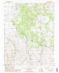
1989 Map of Big Alkali
USGS Topo · Published 1989About this map
The Bridgeport Valley and the western slopes of the Bodie Hills define this landscape during the late 1980s, revealing a terrain shaped by geothermal activity and mining history. Geothermal features like Travertine Hot Springs and The Hot Springs are prominent, accompanied by the Travertine Quarry. The map preserves the location of the Dog Town (Site) Grave, a significant marker for local historians and genealogists tracing early settlement patterns in Mono County.
Find a feature on this map
38 named features on this map. Tap any name to fly to it.
Don’t see what you’re looking for? This feature index may not catch every label — zoom into the map to look around manually.
Map Details
Editions of this 1989 Big Alkali Map
2 editions found
Other maps of this area

1909 · Bridgeport
USGS Topo · 1:125,000

1911 · Bridgeport
USGS Topo · 1:125,000

1920 · Bridgeport
USGS Topo · 1:125,000

1948 · Walker Lake
USGS Topo · 1:250,000

1956 · Fales Hot Springs
USGS Topo · 1:62,500

1956 · Matterhorn Peak
USGS Topo · 1:62,500

1957 · Walker Lake
USGS Topo · 1:250,000

1958 · Bodie
USGS Topo · 1:62,500
1958 · Bridgeport
USGS Topo · 1:62,500

1962 · Walker Lake
USGS Topo · 1:250,000