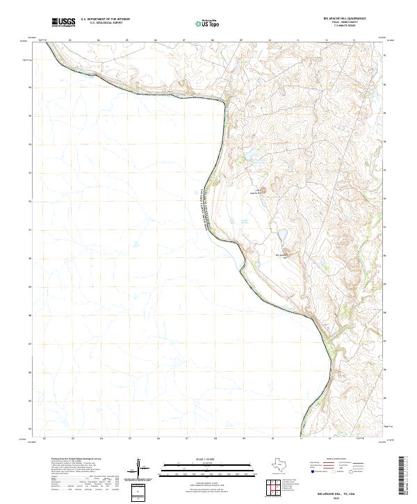
2022 Map of Big Apache Hill
USGS Topo · Published 2022About this map
The Rio Grande serves as the dominant geographic and political line in this modern study of Webb County, defining the international boundary between the United States and Mexico. This stretch of the river is characterized by dramatic elevation changes as the water cuts through the arid landscape of south Texas. To the east of the river, the terrain rises sharply toward Big Apache Hill and its smaller counterpart, Little Apache Hill, which stand as prominent landmarks above the surrounding brush country.
Find a feature on this map
8 named features on this map. Tap any name to fly to it.
Don’t see what you’re looking for? This feature index may not catch every label — zoom into the map to look around manually.
Map Details
Editions of this 2022 Big Apache Hill Map
This is the sole edition of this map. No revisions or reprints were ever made.
Other maps of this area

1923 · Palafox
USGS Topo · 1:62,500

1929 · Cotulla
USGS Topo · 1:125,000

1940 · San Loranzo Creek
USGS Topo · 1:62,500

1940 · Chupadera
USGS Topo · 1:62,500

1953 · Crystal City
USGS Topo · 1:250,000

1955 · Crystal City
USGS Topo · 1:250,000

1956 · Laredo
USGS Topo · 1:250,000

1958 · Eagle Pass
USGS Topo · 1:250,000

1961 · Crystal City
USGS Topo · 1:250,000

1965 · Eagle Pass
USGS Topo · 1:250,000