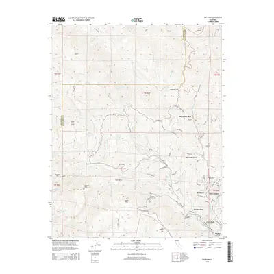
2015 Map of Big Basin
USGS Topo · Published 2015About this map
Butano Ridge and Ben Lomond Mtn define the high terrain of this survey, where the San Lorenzo River and its various tributaries carve through the landscape. This era shows the developed residential clusters along the river corridor, including Wildwood, Riverside Grove, and Forest Springs. The map reveals a dense network of mountain roads such as China Grade Rd and the Saratoga Toll Rd, reflecting the area's history of timber transit and mountain access. In the lower elevations, distinct settlements like Rices Junction and Bracken Brae are situated near the waterways, while landmarks like Eagle Rock and Buzzards Roast mark the higher elevations. The survey documents the complex interface of public recreation lands and private mountain communities as they existed in the early twenty-first century.
Find a feature on this map
103 named features on this map. Tap any name to fly to it.
Don’t see what you’re looking for? This feature index may not catch every label — zoom into the map to look around manually.
Map Details
Editions of this 2015 Big Basin Map
This is the sole edition of this map. No revisions or reprints were ever made.
Other maps of this area

1897 · Palo Alto
USGS Topo · 1:62,500

1899 · Palo Alto
USGS Topo · 1:62,500

1902 · Santa Cruz
USGS Topo · 1:125,000

1940 · Halfmoon Bay
USGS Topo · 1:62,500

1940 · Ano Nuevo
USGS Topo · 1:62,500

1941 · Ano Nuevo Pt.
USGS Topo · 1:62,500

1941 · Palo Alto
USGS Topo · 1:62,500

1942 · Ano Nuevo
USGS Topo · 1:62,500

1943 · Palo Alto
USGS Topo · 1:62,500

1943 · Halfmoon Bay
USGS Topo · 1:62,500