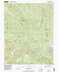
1997 Map of Big Basin
USGS Topo · Published 1999About this map
Big Basin Redwoods State Park dominates the rugged landscape of the Santa Cruz Mountains, revealing a complex network of canyons and ridges defined by the San Lorenzo River and its many tributaries. The survey shows the area's transition into a major conservation and recreation hub by the late 1990s, where older landmarks like the Eagle Rock Lookout Tower and Park Headquarters stand alongside established camps such as Camp Campbell and Camp Ben Lomond.
Find a feature on this map
59 named features on this map. Tap any name to fly to it.
Don’t see what you’re looking for? This feature index may not catch every label — zoom into the map to look around manually.
Map Details
Editions of this 1997 Big Basin Map
This is the sole edition of this map. No revisions or reprints were ever made.
Other maps of this area

1897 · Palo Alto
USGS Topo · 1:62,500

1899 · Palo Alto
USGS Topo · 1:62,500

1902 · Santa Cruz
USGS Topo · 1:125,000

1940 · Halfmoon Bay
USGS Topo · 1:62,500

1940 · Ano Nuevo
USGS Topo · 1:62,500

1941 · Ano Nuevo Pt.
USGS Topo · 1:62,500

1941 · Palo Alto
USGS Topo · 1:62,500

1942 · Ano Nuevo
USGS Topo · 1:62,500

1943 · Palo Alto
USGS Topo · 1:62,500

1943 · Halfmoon Bay
USGS Topo · 1:62,500