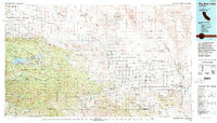
1982 Map of Big Bear Lake
USGS Topo · Published 1996About this map
Big Bear Lake and its surrounding peaks anchor this 1982 landscape, where the high-altitude recreation of the San Bernardino National Forest meets the arid basins of the Mojave. The map reveals a complex transition of terrain, from the timbered heights of San Bernardino Mountain and Ten Thousand Foot Ridge to the sprawling military footprint of the Marine Corps Air Ground Combat Center near Twentynine Palms.
Find a feature on this map
73 named features on this map. Tap any name to fly to it.
Don’t see what you’re looking for? This feature index may not catch every label — zoom into the map to look around manually.
Map Details
Editions of this 1982 Big Bear Lake Map
This is the sole edition of this map. No revisions or reprints were ever made.
Other maps of this area

1899 · Redlands
USGS Topo · 1:62,500

1901 · Southern California Sheet No. 1
USGS Topo · 1:250,000

1901 · San Jacinto
USGS Topo · 1:125,000

1901 · Redlands
USGS Topo · 1:62,500

1901 · Elsinore
USGS Topo · 1:125,000

1902 · Deep Creek
USGS Topo · 1:62,500

1902 · San Gorgonio
USGS Topo · 1:125,000

1904 · Southern California Sheet No. 1
USGS Topo · 1:250,000

1932 · Barstow
USGS Topo · 1:125,000

1934 · Barstow
USGS Topo · 1:125,000