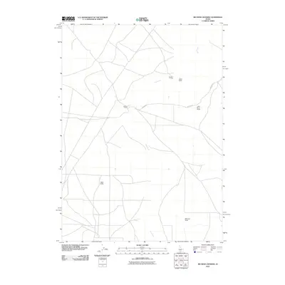
2010 Map of Big Bend Crossing
USGS Topo · Published 2010About this map
Devil Creek meanders through this portion of Twin Falls County, defining a landscape marked by significant geographical transitions and historical passage points. The namesake Big Bend Crossing and the nearby Old Bend Crossing serve as the primary focal points of the area, indicating long-established routes across the water. The surrounding terrain is characterized by prominent high points such as Black Butte and Marshall Butte, which provide a sense of scale to the high desert environment.
Find a feature on this map
8 named features on this map. Tap any name to fly to it.
Don’t see what you’re looking for? This feature index may not catch every label — zoom into the map to look around manually.
Map Details
Editions of this 2010 Big Bend Crossing Map
This is the sole edition of this map. No revisions or reprints were ever made.
Other maps of this area

1955 · Twin Falls
USGS Topo · 1:250,000

1958 · Twin Falls
USGS Topo · 1:250,000

1964 · Roseworth
USGS Topo · 1:24,000

1965 · Tuanna Butte
USGS Topo · 1:24,000

1977 · Cedar Creek Reservoir
USGS Topo · 1:24,000

1979 · Salls Crossing
USGS Topo · 1:24,000

1979 · Coonskin Butte NE
USGS Topo · 1:24,000
1979 · Roseworth
USGS Topo · 1:24,000

1979 · Coonskin Butte
USGS Topo · 1:24,000
1979 · Tuanna Butte
USGS Topo · 1:24,000