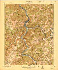
1914 Map of Big Bend
USGS Topo · Published 1914About this map
Hinton serves as the central hub of this West Virginia landscape, situated at the confluence of the New River and the Greenbrier River. The industrial and transport importance of the era is evident through the path of the Chesapeake and Ohio railroad and the significant engineering of the Big Bend Tunnel near Talcott. The map documents a rural infrastructure heavily dependent on river crossings and small local schools, such as the Haines Ferry and the Packs Ferry river access points. Genealogists will find a wealth of named local schools like True School, Falling Rock School, and Madam Creek School dotting the ridges and hollows. Mineral spring resorts like Red Sulphur Springs and Bargers Springs reflect the region's historical role in late 19th-century leisure and wellness tourism before modern developments altered these traditional mountain communities.
Find a feature on this map
146 named features on this map. Tap any name to fly to it.
Don’t see what you’re looking for? This feature index may not catch every label — zoom into the map to look around manually.
Map Details
Editions of this 1914 Big Bend Map
4 editions found

Other maps of this area

1887 · Pocahontas
USGS Topo · 1:125,000

1887 · Hinton
USGS Topo · 1:125,000

1890 · Dublin
USGS Topo · 1:125,000

1891 · Pocahontas
USGS Topo · 1:125,000

1891 · Dublin
USGS Topo · 1:125,000

1891 · Raleigh
USGS Topo · 1:125,000

1892 · Hinton
USGS Topo · 1:125,000

1894 · Pocahontas
USGS Topo · 1:125,000

1895 · Pocahontas
USGS Topo · 1:125,000

1897 · Raleigh
USGS Topo · 1:125,000