
1914 Map of Big Bend
USGS Topo · Published 1914About this map
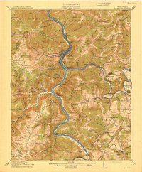
The New River carves a deep, winding course through this early 20th-century landscape, serving as the primary corridor for commerce and transport. The Hinton rail center and the Bellepoint Sta highlight the region's reliance on the Chesapeake and Ohio RR, which navigates the difficult terrain via the engineering feat of the Big Bend Tunnel. Rural life in Summers Co and Sumroe Co is represented by a dense network of mountain schools, such as the Bunker Hill School and Red Sulphur Springs School, alongside essential river crossings like Haines Ferry and Pagas Ferry. The map captures a moment before modern highway infrastructure, where small river settlements like Crumps Bottom and Indian Mills were vital local hubs. Steep ridges like Richmond Mountain and Pipestem Mountain isolate the various creek valleys, creating a highly localized pattern of settlement and agriculture.
Find a feature on this map
136 named features on this map. Tap any name to fly to it.
Don’t see what you’re looking for? This feature index may not catch every label — zoom into the map to look around manually.
Map Details
Editions of this 1914 Big Bend Map
4 editions found
Other maps of this area

1887 · Pocahontas
USGS Topo · 1:125,000

1887 · Hinton
USGS Topo · 1:125,000

1890 · Dublin
USGS Topo · 1:125,000

1891 · Pocahontas
USGS Topo · 1:125,000

1891 · Dublin
USGS Topo · 1:125,000

1891 · Raleigh
USGS Topo · 1:125,000

1892 · Hinton
USGS Topo · 1:125,000

1894 · Pocahontas
USGS Topo · 1:125,000

1895 · Pocahontas
USGS Topo · 1:125,000

1897 · Raleigh
USGS Topo · 1:125,000