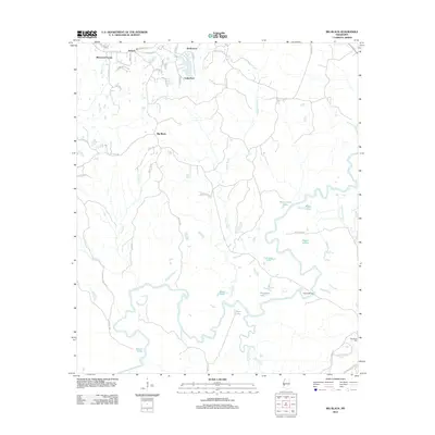
2012 Map of Big Black
USGS Topo · Published 2012About this map
The Big Black River meanders through this portion of Mississippi, creating a complex landscape of oxbow lakes, sloughs, and islands south of Lake Park. This 2012 survey illustrates the hydrological evolution of the river basin, where abandoned channels have formed distinct features like Horseshoe Lake, Baker Lake, and Congo Lake. The presence of Regan Island and numerous named bayous such as Hamer Bayou and Jim Bayou highlights the shifting nature of the river's path over time. Settlement patterns are concentrated in the north, with communities like Sherwood Forest and Timberlane featuring residential road networks such as King Arthurs Rdg and Camelot Dr. In the southeastern corner, the Natchez Trace Pkwy provides a link to the historical transit corridor, while the isolated Henderson Cem and Fishers Bridge offer specific points of interest for genealogists and local historians.
Find a feature on this map
57 named features on this map. Tap any name to fly to it.
Don’t see what you’re looking for? This feature index may not catch every label — zoom into the map to look around manually.
Map Details
Editions of this 2012 Big Black Map
This is the sole edition of this map. No revisions or reprints were ever made.
Other maps of this area

1918 · Vicksburg
USGS Topo · 1:62,500

1938 · Edwards
USGS Topo · 1:62,500

1939 · Yokena
USGS Topo · 1:62,500

1941 · Vicksburg
USGS Topo · 1:62,500

1955 · Jackson
USGS Topo · 1:250,000

1961 · Jackson
USGS Topo · 1:250,000

1962 · Jackson
USGS Topo · 1:250,000

1962 · Vicksburg West
USGS Topo · 1:24,000

1962 · Vicksburg East
USGS Topo · 1:24,000

1962 · Utica West
USGS Topo · 1:24,000