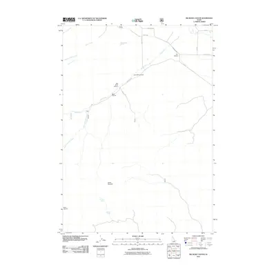
2011 Map of Big Blind Canyon
USGS Topo · Published 2011About this map
Houston Cemetery lies at the northern edge of this high-desert landscape in Custer County, serving as a primary point of interest for genealogists and local historians. The terrain is defined by a series of dramatic drainages and peaks, including the prominent Sheep Mountain and several namesake canyons like Big Blind Canyon, Little Blind Canyon, and Blind Canyon. These natural features dominate the southern and central portions of the map, while the northern section transitions into a system of managed water and access.
Find a feature on this map
22 named features on this map. Tap any name to fly to it.
Don’t see what you’re looking for? This feature index may not catch every label — zoom into the map to look around manually.
Map Details
Editions of this 2011 Big Blind Canyon Map
This is the sole edition of this map. No revisions or reprints were ever made.
Other maps of this area

1935 · MacKay
USGS Topo · 1:96,000

1940 · Mackay
USGS Topo · 1:62,500

1955 · Idaho Falls
USGS Topo · 1:250,000

1958 · Idaho Falls
USGS Topo · 1:250,000

1960 · Grouse
USGS Topo · 1:62,500

1960 · Mackay
USGS Topo · 1:62,500

1969 · Darlington
USGS Topo · 1:24,000
1969 · Methodist Creek
USGS Topo · 1:24,000

1972 · Appendicitis Hill
USGS Topo · 1:24,000
1988 · Arco
USGS Topo · 1:100,000