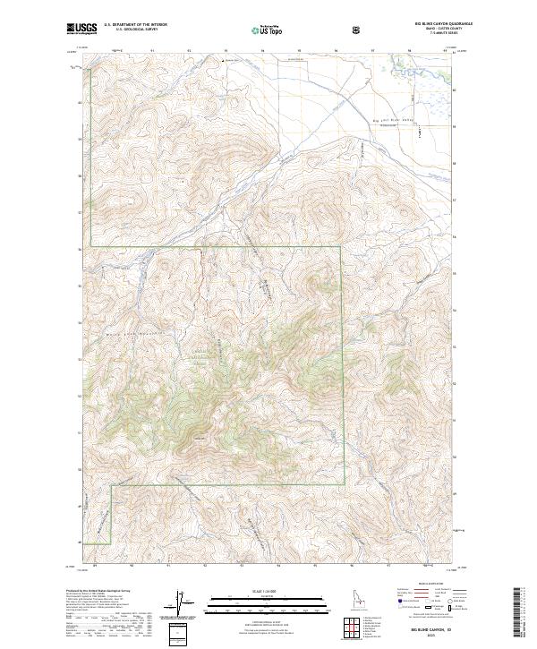
2023 Map of Big Blind Canyon
USGS Topo · Published 2023About this map
The Big Lost River Valley dominates the northeastern corner of this Idaho landscape, where the Big Lost River winds near early water management features like the Darlington Ditch and Rodger Ditch. These irrigation structures reflect the agricultural development of the arid basin, contrasting with the high elevations of the White Knob Mountains and Sheep Mtn that rise to the south and west. Within the boundaries of the Challis National Forest, the terrain is carved by complex drainages including Big Blind Canyon, Bedy Canyon, and Rough Canyon.
Find a feature on this map
38 named features on this map. Tap any name to fly to it.
Don’t see what you’re looking for? This feature index may not catch every label — zoom into the map to look around manually.
Map Details
Editions of this 2023 Big Blind Canyon Map
This is the sole edition of this map. No revisions or reprints were ever made.
Other maps of this area

1935 · MacKay
USGS Topo · 1:96,000

1940 · Mackay
USGS Topo · 1:62,500

1955 · Idaho Falls
USGS Topo · 1:250,000

1958 · Idaho Falls
USGS Topo · 1:250,000

1960 · Grouse
USGS Topo · 1:62,500

1960 · Mackay
USGS Topo · 1:62,500

1969 · Darlington
USGS Topo · 1:24,000
1969 · Methodist Creek
USGS Topo · 1:24,000

1972 · Appendicitis Hill
USGS Topo · 1:24,000
1988 · Arco
USGS Topo · 1:100,000