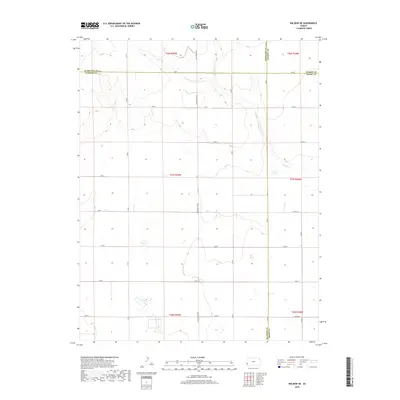
2018 Map of Big Bow NE
USGS Topo · Published 2018About this map
The High Plains of Southwest Kansas converge at a unique four-county junction, where the borders of Hamilton, Stanton, Kearny, and Grant counties meet. This agricultural landscape is defined by its rectilinear grid of section lines and gravel roads, including the prominent north-south thoroughfare known as N Big Bow Grade and its northern extension Big Bow Grade. The terrain is generally level, carved only by the subtle drainage of Wolf Cr, which winds through the northeastern portion of the quadrangle. As of 2018, the area remains dedicated to large-scale farming and ranching, with the map recording the systematic organization of Township 26 through 28 South and Ranges 38 and 39 West. Researchers will find the sparse but vital infrastructure of this rural corridor, from local routes like Co Rd X to the small collection of farmsteads and catchment basins that support life in this semi-arid region.
Find a feature on this map
32 named features on this map. Tap any name to fly to it.
Don’t see what you’re looking for? This feature index may not catch every label — zoom into the map to look around manually.
Map Details
Editions of this 2018 Big Bow NE Map
This is the sole edition of this map. No revisions or reprints were ever made.
Other maps of this area

1891 · Larned
USGS Topo · 1:125,000

1900 · Syracuse
USGS Topo · 1:125,000

1900 · Lakin
USGS Topo · 1:125,000

1920 · Syracuse
USGS Topo · 1:125,000

1955 · Dodge City
USGS Topo · 1:250,000

1958 · Dodge City
USGS Topo · 1:250,000

1959 · Dodge City
USGS Topo · 1:250,000

1959 · Ulysses NW
USGS Topo · 1:24,000

1959 · Big Bow NE
USGS Topo · 1:24,000

1959 · Big Bow NW
USGS Topo · 1:24,000