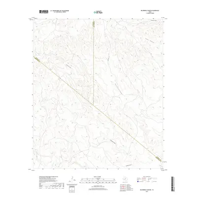
2019 Map of Big Brindle Canyon
USGS Topo · Published 2019About this map
Big Brindle Canyon and Little Brindle Canyon dominate this Trans-Pecos landscape where the borders of Pecos, Terrell, and Brewster counties converge. This high-desert drainage system is defined by deep incisions through the limestone plateau, including Whitely Canyon and the aptly named Washboard Canyon to the east. Human presence is sparse in this 2019 survey, centered largely on the solitary path of Pierce Rd and the intermittent flow of Maxon Cr at the southern edge of the quadrangle. The map captures a moment of modern topographic record-keeping in a region where historical land boundaries, such as those separating the three counties, often follow the natural contours and ridges of the basin and range province. Researchers will find the network of side canyons, like Hagler Canyon, essential for understanding the hydrology and ranching history of this arid interior.
Find a feature on this map
11 named features on this map. Tap any name to fly to it.
Don’t see what you’re looking for? This feature index may not catch every label — zoom into the map to look around manually.
Map Details
Editions of this 2019 Big Brindle Canyon Map
This is the sole edition of this map. No revisions or reprints were ever made.
Other maps of this area

1918 · Bullis Gap
USGS Topo · 1:62,500

1918 · Indian Wells
USGS Topo · 1:62,500

1920 · Longfellow
USGS Topo · 1:125,000

1928 · Sanderson
USGS Topo · 1:125,000

1954 · Fort Stockton
USGS Topo · 1:250,000

1958 · Fort Stockton
USGS Topo · 1:250,000

1959 · Emory Peak
USGS Topo · 1:250,000

1965 · Emory Peak
USGS Topo · 1:250,000

1968 · Big Brindle Canyon
USGS Topo · 1:24,000

1968 · Fresno Creek
USGS Topo · 1:24,000