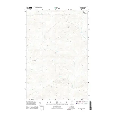
2014 Map of Big Brook Lake
USGS Topo · Published 2014About this map
Big Brook Lake and its surrounding drainage basin define this northern Maine landscape, where water and wood have long shaped the local economy. This remote section of Aroostook County is characterized by a complex network of waterways, including the winding Big Brook and the distinctively named Five Finger Brook. The terrain is marked by significant elevation changes, notably at Dead Horse Gulch in the northeast corner and along the high ridges overlooking Petes Pond and Sag Pond. The presence of Rocky Brook Rd cutting through the center and southern reaches indicates the area's continued use for timber management and backcountry access. These hydrological features, including McKeen Brook and Rocky Brook, feed into larger systems that have historically supported the North Woods' logging industry and recreational traditions.
Find a feature on this map
9 named features on this map. Tap any name to fly to it.
Don’t see what you’re looking for? This feature index may not catch every label — zoom into the map to look around manually.
Map Details
Editions of this 2014 Big Brook Lake Map
This is the sole edition of this map. No revisions or reprints were ever made.
Other maps of this area

1931 · Fish River Lake
USGS Topo · 1:48,000

1931 · Mooseleuk Lake
USGS Topo · 1:48,000

1932 · Musquacook Lakes
USGS Topo · 1:48,000

1932 · Allagash Falls
USGS Topo · 1:48,000

1935 · Musquacook Lakes
USGS Topo · 1:62,500

1935 · Fish River Lake
USGS Topo · 1:62,500

1935 · Mooseleuk Lake
USGS Topo · 1:62,500

1935 · Allagash Falls
USGS Topo · 1:62,500

1954 · Presque Isle
USGS Topo · 1:250,000

1956 · Allagash Falls
USGS Topo · 1:50,000