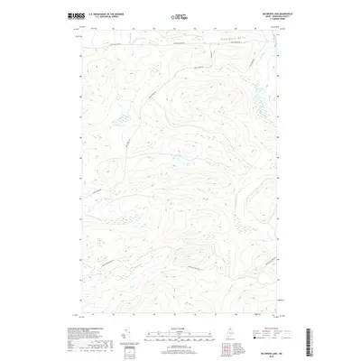
2018 Map of Big Brook Lake
USGS Topo · Published 2018About this map
Big Brook Lake and the surrounding North Maine Woods are defined by an intricate network of waterways and timber-access routes. The landscape is carved by steep drainages like Dead Horse Gulch and punctuated by high-elevation water bodies including Sag Pond and Petes Pond. Evidence of the area's specialized terrain and historical logging activity appears in local names like The Corduroys, likely referring to corduroy roads once used to traverse marshy ground. Transportation in this remote Aroostook County township is limited to unpaved arteries such as Rocky Brook Rd and Twenty Mile Brook Rd, which follow the natural contours of the land. These roads provide the primary access to the numerous tributaries feeding the larger watershed, including McKeen Brook and Five Finger Brook.
Find a feature on this map
14 named features on this map. Tap any name to fly to it.
Don’t see what you’re looking for? This feature index may not catch every label — zoom into the map to look around manually.
Map Details
Editions of this 2018 Big Brook Lake Map
This is the sole edition of this map. No revisions or reprints were ever made.
Other maps of this area

1931 · Fish River Lake
USGS Topo · 1:48,000

1931 · Mooseleuk Lake
USGS Topo · 1:48,000

1932 · Musquacook Lakes
USGS Topo · 1:48,000

1932 · Allagash Falls
USGS Topo · 1:48,000

1935 · Musquacook Lakes
USGS Topo · 1:62,500

1935 · Fish River Lake
USGS Topo · 1:62,500

1935 · Mooseleuk Lake
USGS Topo · 1:62,500

1935 · Allagash Falls
USGS Topo · 1:62,500

1954 · Presque Isle
USGS Topo · 1:250,000

1956 · Allagash Falls
USGS Topo · 1:50,000