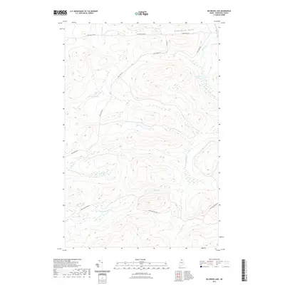
2021 Map of Big Brook Lake
USGS Topo · Published 2021About this map
Big Brook Lake sits at the center of this remote North Woods landscape in T14 R10 WELS, defined by a network of logging roads and winding watercourses. The drainage of Big Brook and Rocky Brook shapes the topography, where names like Dead Horse Gulch and The Corduroys hint at the difficult passage faced by early woodsmen and foresters. The 2021 survey shows a terrain largely dedicated to timber production, evidenced by the extensive path of Rocky Brook Rd and Twenty Mile Brook Rd cutting through the ridges. Small, isolated bodies of water such as Petes Pond and Sag Pond provide breaks in the heavy forest cover. This map records the modern state of the Maine timberlands, where industrial forestry infrastructure overlays a landscape of ancient brooks and marshes including Five Finger Brook and McKeen Brook.
Find a feature on this map
14 named features on this map. Tap any name to fly to it.
Don’t see what you’re looking for? This feature index may not catch every label — zoom into the map to look around manually.
Map Details
Editions of this 2021 Big Brook Lake Map
This is the sole edition of this map. No revisions or reprints were ever made.
Other maps of this area

1931 · Fish River Lake
USGS Topo · 1:48,000

1931 · Mooseleuk Lake
USGS Topo · 1:48,000

1932 · Musquacook Lakes
USGS Topo · 1:48,000

1932 · Allagash Falls
USGS Topo · 1:48,000

1935 · Musquacook Lakes
USGS Topo · 1:62,500

1935 · Fish River Lake
USGS Topo · 1:62,500

1935 · Mooseleuk Lake
USGS Topo · 1:62,500

1935 · Allagash Falls
USGS Topo · 1:62,500

1954 · Presque Isle
USGS Topo · 1:250,000

1956 · Allagash Falls
USGS Topo · 1:50,000