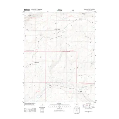
2013 Map of Big Bucktail Creek
USGS Topo · Published 2013About this map
The San Miguel River cuts through the southwestern corner of this Colorado landscape, shaping the steep walls of San Miguel Canyon and the surrounding high-desert plateaus. Within the Uncompahgre National Forest, the terrain is defined by a series of mesas and drainages, most notably Pinto Mesa and the winding course of Big Bucktail Creek. Small rural settlements like Mountain View and Piñon mark the limited human footprint in a region dominated by canyons and complex water management systems.
Find a feature on this map
33 named features on this map. Tap any name to fly to it.
Don’t see what you’re looking for? This feature index may not catch every label — zoom into the map to look around manually.
Map Details
Editions of this 2013 Big Bucktail Creek Map
This is the sole edition of this map. No revisions or reprints were ever made.
Other maps of this area

1916 · Paradox Valley
USGS Topo · 1:125,000

1922 · Paradox Valley
USGS Topo · 1:125,000

1956 · Moab
USGS Topo · 1:250,000

1959 · Moab
USGS Topo · 1:250,000

1960 · Moab
USGS Topo · 1:250,000
1960 · Nucla
USGS Topo · 1:24,000
1960 · Nucla
USGS Topo · 1:62,500
1960 · Windy Point
USGS Topo · 1:24,000

1962 · Moab
USGS Topo · 1:250,000

1964 · Moab
USGS Topo · 1:250,000