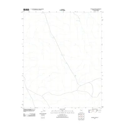
2011 Map of Big Bud Tank
USGS Topo · Published 2011About this map
Murphy Johnson Tank and a series of numbered water catchments characterize this Coconino County landscape during the early 21st century. The map provides a look at the essential water infrastructure required for ranching or land management in this arid part of the state. A primary north-south route cuts through the center of the sheet, linking Tank Number One, Big Bud Tank, and Tank Number Two. This arrangement of water resources, including Tank Number Three, reflects the necessity of managed stock tanks for supporting activity across the high desert terrain. The minimal development shown suggests a region focused on large-scale grazing and natural resource oversight rather than residential settlement.
Find a feature on this map
5 named features on this map. Tap any name to fly to it.
Don’t see what you’re looking for? This feature index may not catch every label — zoom into the map to look around manually.
Map Details
Editions of this 2011 Big Bud Tank Map
This is the sole edition of this map. No revisions or reprints were ever made.
Other maps of this area

1886 · Chino
USGS Topo · 1:250,000

1891 · Chino
USGS Topo · 1:250,000

1948 · Williams
USGS Topo · 1:250,000

1954 · Williams
USGS Topo · 1:250,000

1956 · Williams
USGS Topo · 1:250,000

1960 · Williams
USGS Topo · 1:250,000

1961 · Williams
USGS Topo · 1:250,000
1973 · Mount Floyd
USGS Topo · 1:24,000
1980 · Rose Well Camp West
USGS Topo · 1:24,000
1980 · Black Tank
USGS Topo · 1:24,000