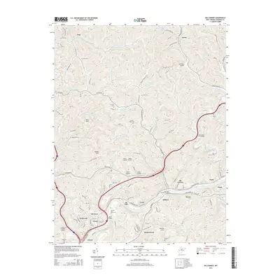
2014 Map of Big Chimney
USGS Topo · Published 2014About this map
The Elk River carves a deep valley through this portion of Kanawha County, shaping the development of communities like Big Chimney, Mink Shoals, and Pinch. The river valley acts as a primary corridor for infrastructure, evidenced by the New Big Chimney Bridge and the cluster of residential growth in Elk Hills and Knollwood. Away from the river, the landscape rises into a series of hollows and ridges, such as Hammack Hollow and Tarkin Hollow, where smaller settlements like Legg and Aarons are tucked into the drainages of Tupper Cr and Aarons Fork. Numerous family and community burial sites, including the Given Cem, Jones Cem, and Rock Memorial Cem, are scattered across the higher ground, providing a geographic record of local lineage. The presence of the Coonskin Park Golf Course near Wilson indicates the transition of the riverbanks toward modern recreational use.
Find a feature on this map
113 named features on this map. Tap any name to fly to it.
Don’t see what you’re looking for? This feature index may not catch every label — zoom into the map to look around manually.
Map Details
Editions of this 2014 Big Chimney Map
This is the sole edition of this map. No revisions or reprints were ever made.
Other maps of this area

1897 · Kanawha Falls
USGS Topo · 1:125,000

1899 · Charleston
USGS Topo · 1:125,000

1900 · Kanawha Falls
USGS Topo · 1:125,000

1901 · Kanawha Falls
USGS Topo · 1:125,000

1906 · Kenna
USGS Topo · 1:62,500

1906 · Walton
USGS Topo · 1:62,500

1907 · Kenna
USGS Topo · 1:62,500

1907 · Walton
USGS Topo · 1:62,500

1907 · Clendenin
USGS Topo · 1:62,500

1909 · Charleston
USGS Topo · 1:62,500