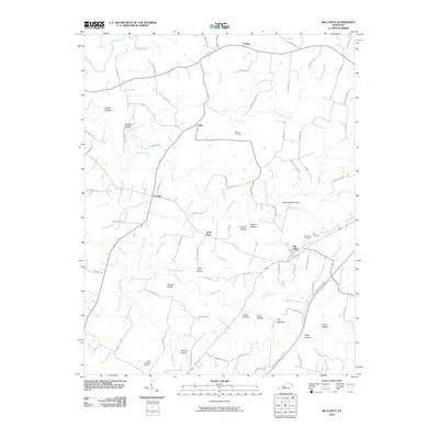
2010 Map of Big Clifty
USGS Topo · Published 2010About this map
Meeting Creek and the Rough River wind through this corner of Grayson County, carving a landscape defined by deep hollows and high ridges. The community of Saint Paul serves as a central hub, surrounded by smaller rural settlements like Limp, Tar Hill, and Solway. This 2010 survey illustrates the local reliance on a network of backroads—such as St Paul Rd and Dry Ridge Rd—that connect family homesteads and parish sites.
Find a feature on this map
88 named features on this map. Tap any name to fly to it.
Don’t see what you’re looking for? This feature index may not catch every label — zoom into the map to look around manually.
Map Details
Editions of this 2010 Big Clifty Map
This is the sole edition of this map. No revisions or reprints were ever made.
Other maps of this area

1922 · Leitchfield
USGS Topo · 1:48,000

1925 · Cub Run
USGS Topo · 1:62,500

1925 · Leitchfield
USGS Topo · 1:62,500

1932 · Big Clifty
USGS Topo · 1:62,500

1949 · Constantine
USGS Topo · 1:24,000

1949 · Summit
USGS Topo · 1:24,000
1949 · Howe Valley
USGS Topo · 1:24,000

1949 · Big Clifty
USGS Topo · 1:24,000

1949 · Big Clifty
USGS Topo · 1:62,500

1953 · Custer
USGS Topo · 1:24,000