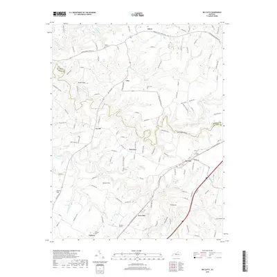
2019 Map of Big Clifty
USGS Topo · Published 2019About this map
Big Clifty and West Clifty serve as central points in this portion of Grayson County, where the landscape is defined by the winding drainages of Meeting Cr and Clifty Cr. The map reveals a rural structure of interconnected hamlets such as Tar Hill, Saint Paul, and Solway, many of which are linked by historic routes like Sonora Hardin Springs Rd and Salt River Rd. Local history is anchored by numerous burial grounds, including Saint Pauls Cem and Cedar Hill Cem, reflecting generations of settlement near the Hardin County line.
Find a feature on this map
67 named features on this map. Tap any name to fly to it.
Don’t see what you’re looking for? This feature index may not catch every label — zoom into the map to look around manually.
Map Details
Editions of this 2019 Big Clifty Map
This is the sole edition of this map. No revisions or reprints were ever made.
Other maps of this area

1922 · Leitchfield
USGS Topo · 1:48,000

1925 · Cub Run
USGS Topo · 1:62,500

1925 · Leitchfield
USGS Topo · 1:62,500

1932 · Big Clifty
USGS Topo · 1:62,500

1949 · Constantine
USGS Topo · 1:24,000

1949 · Summit
USGS Topo · 1:24,000
1949 · Howe Valley
USGS Topo · 1:24,000

1949 · Big Clifty
USGS Topo · 1:24,000

1949 · Big Clifty
USGS Topo · 1:62,500

1953 · Custer
USGS Topo · 1:24,000