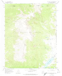
1963 Map of Big Costilla Peak
USGS Topo · Published 1974About this map
The high alpine terrain of the Sangre de Cristo mountains dominates this mid-century survey of the New Mexico and Colorado borderlands. At the heart of the landscape is Big Costilla Peak, surrounded by a complex network of glacial features and high-altitude water bodies. To the southeast, the Costilla Reservoir serves as a major landmark, fed by numerous seasonal and perennial flows including Santistevan Creek and Allen Creek.
Find a feature on this map
22 named features on this map. Tap any name to fly to it.
Don’t see what you’re looking for? This feature index may not catch every label — zoom into the map to look around manually.
Map Details
Editions of this 1963 Big Costilla Peak Map
3 editions found

Other maps of this area

1954 · Raton
USGS Topo · 1:250,000

1954 · Trinidad
USGS Topo · 1:250,000

1955 · Trinidad
USGS Topo · 1:250,000

1958 · Raton
USGS Topo · 1:250,000

1958 · Trinidad
USGS Topo · 1:250,000

1959 · Trinidad
USGS Topo · 1:250,000

1962 · Ash Mountain
USGS Topo · 1:62,500

1963 · Amalia
USGS Topo · 1:24,000

1963 · Latir Peak
USGS Topo · 1:24,000

1963 · Comanche Point
USGS Topo · 1:24,000