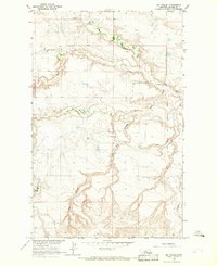
1964 Map of Big Coulee
USGS Topo · Published 1967About this map
The Fort Belknap Indian Reservation Boundary defines the eastern edge of this 1964 survey, marking a distinct line between reservation lands and the surrounding Blaine County range. The landscape is defined by the carved drainages of Big Coulee and Snake Creek, which reveal a complex system of erosion and water management in a semi-arid environment. At the center of this terrain stands Snake Butte, a prominent landmark that serves as the namesake for the local Snake Butte Sch.
Find a feature on this map
10 named features on this map. Tap any name to fly to it.
Don’t see what you’re looking for? This feature index may not catch every label — zoom into the map to look around manually.
Map Details
Editions of this 1964 Big Coulee Map
This is the sole edition of this map. No revisions or reprints were ever made.
Other maps of this area

1904 · Chinook
USGS Topo · 1:62,500

1905 · Harlem
USGS Topo · 1:62,500

1912 · Zurich
USGS Topo · 1:125,000

1913 · Cherry Ridge
USGS Topo · 1:125,000

1953 · Havre
USGS Topo · 1:250,000

1956 · Cleveland
USGS Topo · 1:62,500

1957 · Havre
USGS Topo · 1:250,000

1958 · Havre
USGS Topo · 1:250,000
1964 · Fort Belknap Agency
USGS Topo · 1:24,000
1964 · Fort Belknap Siding
USGS Topo · 1:24,000