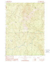
1989 Map of Big Craggies
USGS Topo · Published 1989About this map
Kalmiopsis Wilderness dominates this portion of the Siskiyou National Forest, where the landscape is defined by the steep drainage basins of the Chetco River and the Illinois River. The topography is particularly dense around the Big Craggies and Collier Butte, revealing a network of remote peaks and ridges that historically served as critical landmarks for early foresters and surveyors. Notable open spaces such as High Prairie, Upper Mislatnah Prairie, and Lately Prairie offer a distinct contrast to the heavy timber and narrow creek valleys. Human presence is sparse, concentrated at sites like Jacks Camp, illustrating the region's managed transition from early resource extraction to protected wilderness. The confluence of numerous watercourses including Mislatnah Creek, Blue Slide Creek, and Collier Creek highlights the complex hydrologic system feeding into the major river corridors of southwestern Oregon.
Find a feature on this map
22 named features on this map. Tap any name to fly to it.
Don’t see what you’re looking for? This feature index may not catch every label — zoom into the map to look around manually.
Map Details
Editions of this 1989 Big Craggies Map
This is the sole edition of this map. No revisions or reprints were ever made.
Other maps of this area

1917 · Kerby
USGS Topo · 1:125,000

1918 · Kerby
USGS Topo · 1:125,000

1945 · Kerby
USGS Topo · 1:125,000

1954 · Coos Bay
USGS Topo · 1:250,000

1954 · Chetco Peak
USGS Topo · 1:62,500

1954 · Collier Butte
USGS Topo · 1:62,500

1954 · Mt. Emily
USGS Topo · 1:62,500

1954 · Pearsoll Peak
USGS Topo · 1:62,500

1955 · Medford
USGS Topo · 1:250,000

1957 · Medford
USGS Topo · 1:250,000