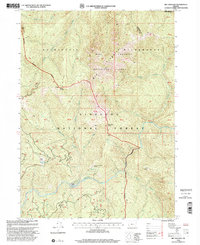
1998 Map of Big Craggies
USGS Topo · Published 2001About this map
Big Craggies and the surrounding peaks of the Siskiyou National Forest dominate this landscape, which remains largely roadless except for a lone 4wd route winding through the interior. The survey captures the wild character of the Kalmiopsis Wilderness and the protected Big Craggies Botanical Area, where the terrain drops sharply toward the Chetco River and its numerous tributaries like Mislatnah Creek and Collier Creek.
Find a feature on this map
35 named features on this map. Tap any name to fly to it.
Don’t see what you’re looking for? This feature index may not catch every label — zoom into the map to look around manually.
Map Details
Editions of this 1998 Big Craggies Map
This is the sole edition of this map. No revisions or reprints were ever made.
Other maps of this area

1917 · Kerby
USGS Topo · 1:125,000

1918 · Kerby
USGS Topo · 1:125,000

1945 · Kerby
USGS Topo · 1:125,000

1954 · Coos Bay
USGS Topo · 1:250,000

1954 · Chetco Peak
USGS Topo · 1:62,500

1954 · Collier Butte
USGS Topo · 1:62,500

1954 · Mt. Emily
USGS Topo · 1:62,500

1954 · Pearsoll Peak
USGS Topo · 1:62,500

1955 · Medford
USGS Topo · 1:250,000

1957 · Medford
USGS Topo · 1:250,000