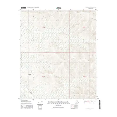
2016 Map of Big Delta C-6 NW
USGS Topo · Published 2016About this map
Eielson Afb dominates the western edge of this interior Alaska landscape, providing a clear view of the military installation's proximity to critical state infrastructure during the mid-2010s. The Alaska Pipeline cuts a distinct path through the southwestern corner, tracing a route across the terrain near the headwaters of French Cr. This area is defined by the drainage systems of Moose Cr, which meanders through the northern sections of the townships. The map illustrates the structured division of the Alaskan wilderness through the Public Land Survey System, specifically marking the boundaries of t2s r4e and t2s r5e. The absence of major civilian settlements highlights the region's primary roles in national defense and energy transport, set against a backdrop of complex wetland networks and varying elevations.
Find a feature on this map
8 named features on this map. Tap any name to fly to it.
Don’t see what you’re looking for? This feature index may not catch every label — zoom into the map to look around manually.
Map Details
Editions of this 2016 Big Delta C-6 NW Map
This is the sole edition of this map. No revisions or reprints were ever made.
Other maps of this area

1949 · Fairbanks D-1
USGS Topo · 1:62,500

1949 · Fairbanks C-1
USGS Topo · 1:63,360

1949 · Big Delta C-6
USGS Topo · 1:63,360

1950 · Fairbanks
USGS Topo · 1:250,000

1950 · Big Delta
USGS Topo · 1:250,000

1950 · Big Delta D-6
USGS Topo · 1:63,360

1950 · Fairbanks C-1
USGS Topo · 1:63,360

1951 · Big Delta
USGS Topo · 1:250,000

1951 · Fairbanks
USGS Topo · 1:250,000

1952 · Big Delta C-6
USGS Topo · 1:63,360